The award winning 3D City Database is a free geo database to store, represent, and manage virtual 3D city models on top of a standard spatial relational database. The database schema implements the CityGML standard with semantically rich and multi-scale urban objects facilitating complex analysis tasks, far beyond visualization. 3DCityDB is in productive and commercial use for more than 14 years in many places around the world. It is also employed in numerous research projects related to 3D city models. The 3D City Database comes with tools for easy data exchange and coupling with cloud services. The 3D City Database content can be directly exported in KML, COLLADA, and glTF formats for the visualisation in a broad range of applications like Google Earth, ArcGIS, and the WebGL-based Cesium Virtual Globe.
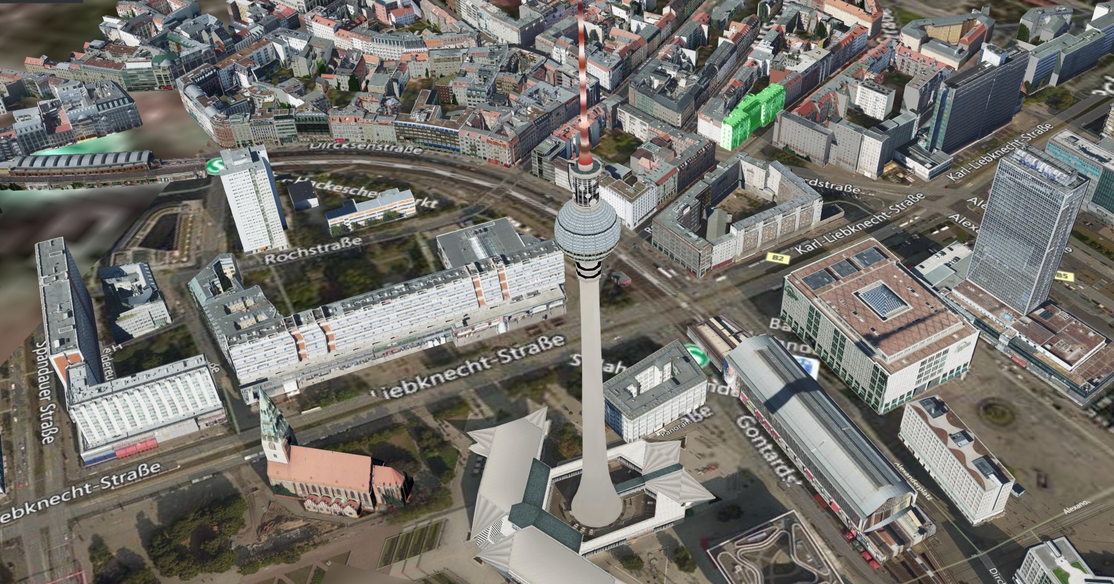
A semantic 3D city model of the German capital Berlin is freely available to the public as open data in CityGML format, which contains around 550,000 LoD2 building objects within the whole city area (890 km²).
Visualization of the 3D City Model of New York City
The Chair of Geoinformatics at Technical University of Munich has created the first publicly available big semantic 3D city model of New York City (NYC) derived from existing public 2D, 2.5D, and 3D datasets automatically.
Visualizations for Different Applications
The 3D City Database contains the semantically rich all-purpose city model based on CityGML. This base data can be exported in different 3D visualization formats and styles to meet specific customer needs.
Export of thematic data to spreadsheets (CSV and Microsoft Excel)
Batch mode & Graphical User Interface
3DCityDB- Web-Map-Client
Extension of the CesiumJS 3D virtual globe by:
Support for efficient displaying, dynamic loading and unloading of large 3D visualization models in the form of tiled KML/glTF datasets exported from the 3DCityDB using the Importer/Exporter
Layer management for adding and removing an arbitrary number of data layers like 3D visualization model (KML/glTF), 3DTiles datasets, WMS imagery layer, and Cesium digital terrain model
3D visualization models can be linked with Google Spreadsheets or database tables via PostgREST for dynamic querying of thematic data for clicked 3D objects
Rich interaction with 3D visualization models, e.g. highlighting of 3D objects on mouse-over and mouse click as well as hiding of selected 3D objects
Toggle shadow casting for 3D objects and terrain
Explore a selected 3D object from different view perspectives using third-party services like Microsoft Bing Maps oblique view, Google Streetview, and a combined version (DualMaps)
Save and share 3DCityDB web client projects using scene links (everything is stored in the URL)
PARTNERS
The 3D City Database V4 and its tools have been jointly developed by the following partners: